
Historical Atlas of the Euroregion Elbe/Labe available
26.10.2022
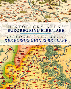
Historically, there are very close relations between Saxony and Bohemia. This can also be seen on old maps. For this reason, the Euroregion Elbe/Labe has published an atlas with historical maps of Bohemia and Saxony with a special focus on the territory of today's Euroregion.
There are 62 maps on 128 pages. The oldest is from 1280, the most recent are tourist maps from 1930. Explanations in German and Czech are included for all maps and various cartographic and historical topics (see below for table of contents). Thanks to the large format (38 cm by 31 cm) and high quality printing, many details are visible. Some special features are highlighted again in enlargements.
The atlas is now available at the Euroregion office in Dresden as well as in some bookshops in the region at a price of 30 Euro. For a shipping fee of 5 Euro and against prepayment we will also gladly send it to you. If you want to get an idea beforehand, you can download the atlas as PDF (Attention: 55 MB).
 The creation of the atlas was supported with funds from the European Union from the Small Projects Fund in the Elbe/Labe Euroregion.