
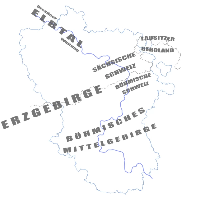
Nature and Landscape
Elbe river
 The connecting element of the region is the Elbe River (Labe in Czech). It flows through the Euroregion from southeast to northwest over a length of approx. 180 km.
Landscapes
The Elbe springs in the Giant Mountains on the Czech-Polish border and initially flows south, then makes a large curve to the west. At Mělník, shortly before it reaches the Euroregion Elbe/Labe, it joins the Vltava. The continuing river should actually be called Vltava, because at the confluence it is both longer (430 km vs. 260 km) and richer in water. But it still flows as the Elbe, initially through quite a flat landscape.
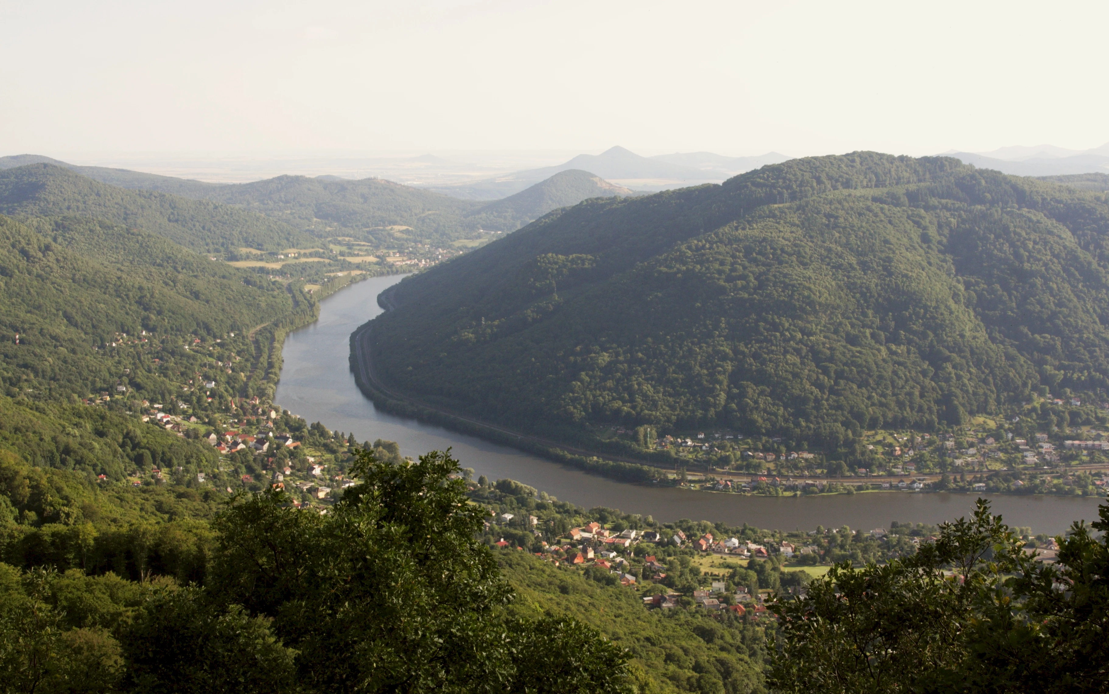
At Litoměřice it reaches the Bohemian Central Mountains. The place between the first high mountains is called Porta Bohemica. With a few bends, the Elbe now makes its way through the Bohemian Central Mountains and the adjoining Elbsandsteingebirge. There are many beautiful views of the river in both mountain ranges. One of them (at Buková Hora) was considered by Alexander von Humboldt to be one of the most beautiful views in the world.
After Saxon Switzerland, the Elbe flows through the so-called Dresden Elbe valley widening, which extends from Pirna to Meißen, with little gradient. Originally it formed many branches, floodplains and swamps here, but this has long since changed due to centuries of settlement. Thanks to the favorable climate, viticulture is possible on the slopes on the right bank of the Elbe.
Water quality
Before 1989, the Elbe was a very dirty river, into which many wastewaters from chemical plants and from settlements were discharged largely untreated on both the Czech and German sides. However, the situation has improved significantly since then. You can now swim again in the Elbe (which is not common because of the current), and the salmon released by the millions in the tributaries and other fish have also returned.
Flood
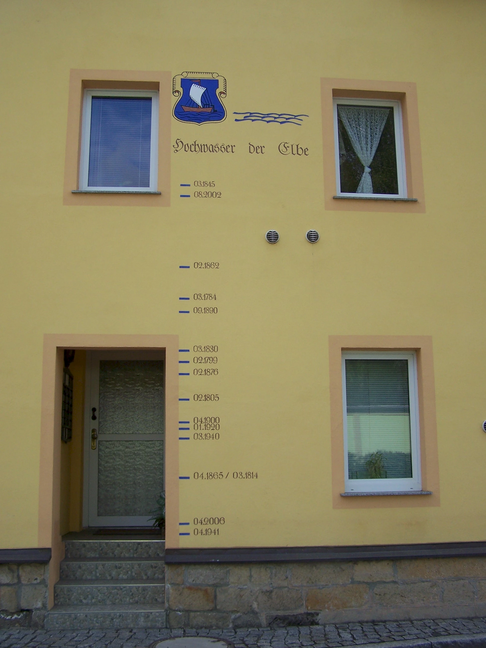
The Elbe occasionally tends to flood, which is partly due to the fact that almost the entire area of the Czech Republic sends its waters over the Elbe towards the North Sea, since the Bohemian Basin is almost completely surrounded by mountains that represent the watersheds. In 2002, the first "flood of a century" in a long time caused great destruction. Since then, a lot has been invested in flood protection (including at the tributaries), so that the next "flood of a century" in 2013 turned out to be much less destructive despite similar water levels. In the narrow Elbe valley in Bohemian and Saxon Switzerland, however, protection is hardly possible. If you are looking for the markings of the high water levels from years like 2002 or 1845 on houses, you have to put your head back quite far.
River kilometrage
The Elbe can be tracked according to different systems. Originally, kilometer zero was located at the confluence with the Vltava. At the German-Czech border near Hřensko, this resulted in river kilometer 109. For several years now, the kilometerage has followed the often used system of counting up from the river mouth. Thus, on the Czech side, the river kilometers 829 to 726 lie in the Euroregion.
The signposted German river kilometrage begins at the Gelobtbach and initially runs 3.5 km parallel to the Czech one, as the state border is in the middle of the river. At river kilometer 70 the Elbe leaves the Euroregion Elbe/Labe and flows a further 660 km to the North Sea.
Shipping
The Elbe has been an important inland waterway for centuries. On the Czech side, several barrages (the last one near Ústí nad Labem) ensure year-round navigability and flood control. On the German side, the river is not regulated and is more and more often not navigable due to the low water. Climate change will increasingly cause such situations. The flat steamers of the Weißes Flotte Dresden are usually the last ones that can still sail. As a result, the amount of goods transported on the river on this part of the Elbe has decreased significantly since 1990.
The Czech side has been discussing plans for some years to build another barrage near Děčín. On the German side, this project is rejected mainly because of the environmental impact.
Eastern Erzgebirge
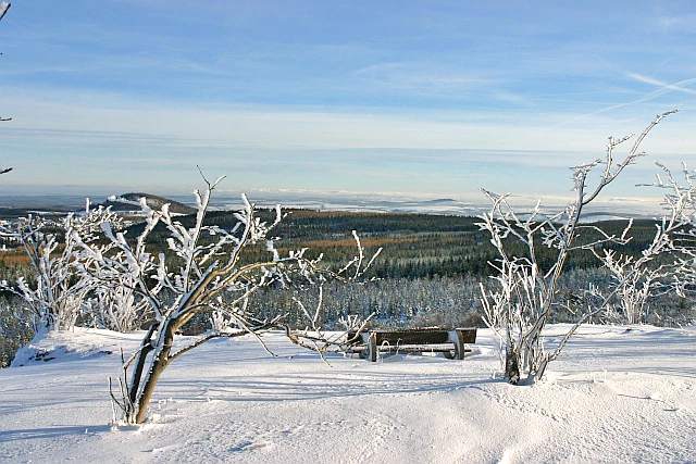
The highest mountains in the Elbe / Labe Euroregion can be found in the Ore Mountains. This mountain range extends over a length of 150 km along the Saxon-Czech border, which runs roughly on its ridge. Only the Eastern Ore Mountains are about 25 km in length in the Elbe / Labe Euroregion.
On the German side, the Eastern Ore Mountains rise slowly from the edge of the Elbe valley to the south, then drop off steeply on the Czech side (Pultscholle). This shape is due to strong forces at depth that lifted the plate (during the Alpid mountain formation in the Tertiary) in the south until it broke. The breakline is now the ridge. Further evidence of these forces are the cone mountains of former volcanoes in the southern Bohemian Central Uplands, but also in isolated cases in the Ore Mountains.
Striking for the Eastern Ore Mountains are relatively gentle elevations, partly deeply cut valleys, mainly in a south-north orientation, colorful mountain meadows and the elongated mountain ridge on the edge of further plateaus.
The highest elevations in the area of the Elbe / Labe Euroregion are on the Czech side the - unfortunately not very striking - Pramenáč (Bornhauberg) with 909 m and on the German side the Kahleberg at 905 m, which with its elongated shape and the steep drop at the western end is easily recognizable from afar.
Saxon and Bohemian Switzerland
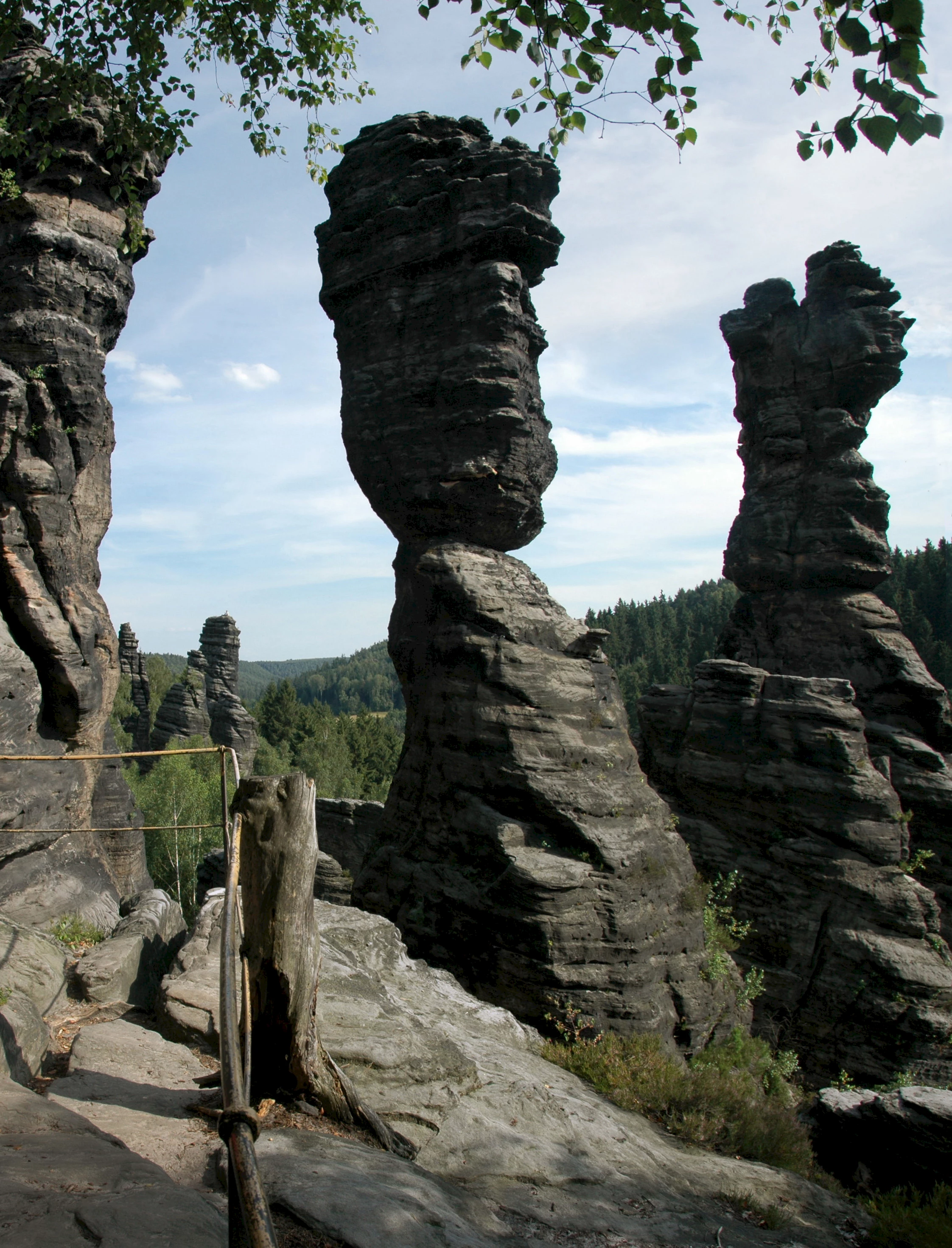
The mountain range with the most visitors is the Elbsandsteingebirge (Elbe Sandstone Mountains), usually called Saxon Switzerland and Bohemian Switzerland. The border to the Eastern Erzgebirge is usually located near Petrovice.
As the name suggests, the Elbsandsteingebirge is characterized by sandstone that has often taken on bizarre shapes due to erosion. The sandstone was created by deposits in a shallow Cretaceous sea. This was caused by the subsidence of an area between the Lusatian mountains in the northeast and the Ore Mountains in the southwest. Later the area gradually rose again, the sea drained and the sandstone layers were exposed. Tectonic forces acting from the side created cracks that became deeper and wider due to the strong erosion of the rather soft sandstone. On the one hand, this created many bizarre formations, some of them quite filigree stone structures, but also a number of striking table mountains.
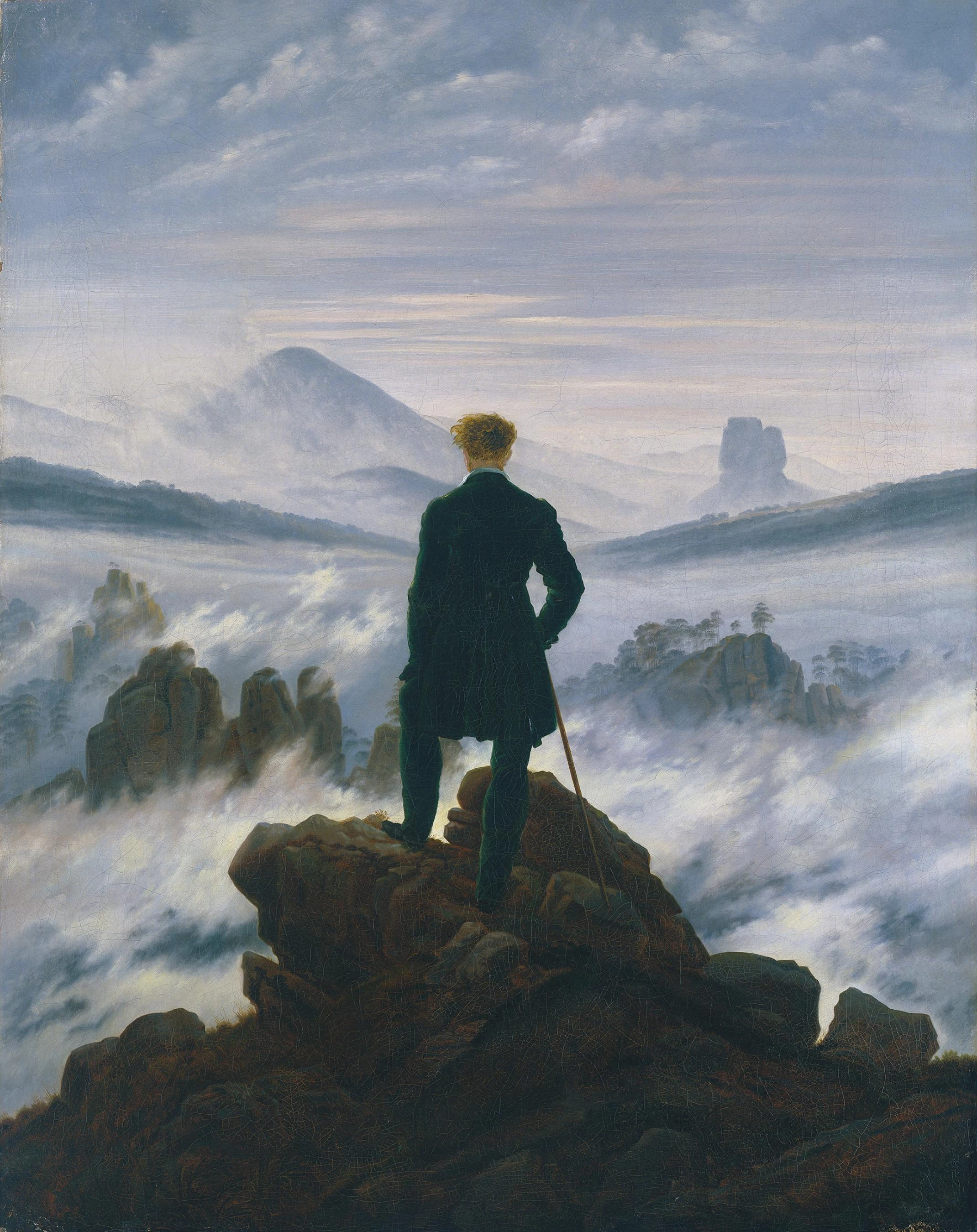
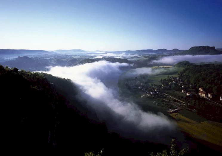
Saxon Switzerland in particular became a popular excursion destination quite early, at the beginning of the 19th century. The beauty of the landscape enchanted many artists, especially the romantic painters (Caspar David Friedrich, Ludwig Richter). They were enchanted by the mystical mood, which is enhanced by the frequent morning mist.
The bizarre rocky landscape not only attracts many tourists, but also makes the area an Eldorado for rock climbing (mostly called mountaineering here). Saxon rock climbing is one of the oldest climbing traditions in the world with roots in the second half of the 19th century. A special feature is the deep rooted consideration that has been given to the sensitivity of both the soft sandstone and nature in general from the very beginning. Climbing, for example, must be carried out completely on the existing rock, artificial devices (normally slings, no metal devices) may only be used - as few as possible - for securing, but not for climbing. The use of magnesia and the like is prohibited. Due to these strict rules, the in many other climbing areas very strong differences between nature conservationists and climbers (mostly to the disadvantage of the latter) are far less pronounced in Saxon - and Bohemian - Switzerland.
The highest point in Bohemian Switzerland is the Děčínský Sněžník with 723 m, an impressive, elongated table mountain with great views in all directions. The highest point in Saxon Switzerland is the Großer Winterberg (556m), a rather modest mountain that hardly plays a role compared to the impressive rock faces and peaks.
The national parks of Saxon and Bohemian Switzerland protect large parts of the unique natural area.
Central Bohemian Mountains
South of the Erzgebirge and Bohemian Switzerland lie the Bohemian Central Mountains. They are characterized by individual, mostly cone-shaped mountains, former volcanic cones.
To the west of the Elbe River, these individual cone-shaped mountains rising from a (nearly) plain between Bílina and Cheb are particularly striking. The highest and, due to its clear shape, particularly striking is Milešovka (Milleschauer) at 836m. The view from its top was counted by Alexander von Humboldt (also) as one of the most beautiful views in the world. This part of the mountain is more attractive to tourists and better developed than the eastern part. Many of the cone mountains form special biotopes with rare or for these latitudes untypical plants either because of the special geological structure or because of a very special microclimate on the steep slopes.
The eastern part of the Bohemian Central Mountains is a more classic mountain range, with mountains or hills and valleys. Despite the fact that the mountains usually do not rise very high, you still have a very wide view from various places.
Towards the south, the Bohemian Central Mountains merge into the lowlands of the Cheb and the Elbe rivers.
