Euroregion Elbe/Labe

The border region on historical maps

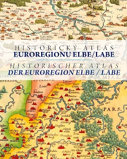
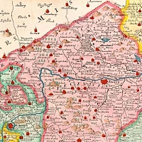
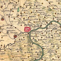
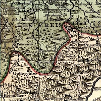
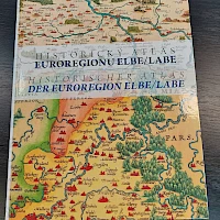
In June 2022, the Elbe/Labe Euroregion published an atlas of historical maps of Bohemia, Saxony and in particular the border area of today's Euroregion.

Past comes to live

Looking at old maps opens up new perspectives and brings insights in many ways. On the one hand, it shows the picture that people had of the world in earlier times. The maps make it clear what importance was attached to different cities, landscapes, rivers, etc. at different times. Cities and villages have seen interesting ascents and descents over the centuries. In the Saxon-Bohemian border area, historical maps also show the traditionally close relationships across the border.

Click to download as PDF (55 MB)

The maps also show the development of cartography very nicely. This not only applies to the representation of geography, but also to the many artistic elements that were usually arranged around it. Many of the cards are real works of art.

Historical atlas of the border region

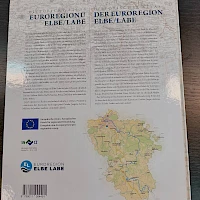
The Euroregion Elbe/Labe has now published an atlas with historical maps of Bohemia and Saxony with a special focus on the area of today's Euroregion. It contains are 62 maps on 128 pages. The oldest is from 1280, the newest are tourist maps from 1930. Explanations in German and Czech are included for all maps and various cartographic and historical topics (see table of contents below).

Thanks to the large format (38 cm by 31 cm) and the high-quality print, many details are recognizable. Some special features are highlighted furthermore in enlargements.

If you want to get a picture before you buy, you can download the atlas (in reduced image quality) as a PDF (note: 55 MB).


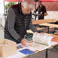
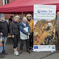
The creation of the atlas was funded by the European Union from the small project fund in the Euroregion Elbe/Labe. On June 25, 2022, the publication was presented to the public on the occasion of the celebrations for the 30th anniversary of the Euroregion Elbe/Labe.


Where to get it

The atlas is available from the Euroregion office in Dresden for 30 euros. For a shipping fee of 5 euros (in Germany) and against payment in advance, we will also be happy to send it to you.

The easiest way to order the atlas is to use the order form. If you then get the transfer underway quickly, we can send you the atlas promptly. The form is for orders with shipping to Germany only (to other countries see below).

To the order form

However, you can also send us an email to infoelbelabe.eu or contact us in some other way.

We are also happy to send the atlas abroad. For shipping to the Czech Republic you will find the necessary information in the Czech language version of this page . For shipping to other countries, please contact us in advance.

Table of Contents

I. FROM SOURCE

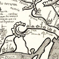
  • The world map by J. Ruysch
  • Orbis terrarum of P. plancius
  • The world map by JBL Clouet
  • H. Moll's map of Europe
  • Thompson's map of Europe

II. IN THE BOHEMIAN BASIN

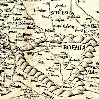
  • The map of Bohemia by S. Munster
  • The map of Bohemia by B. Zalteri
  • The map of Bohemia by J. Criginger
  • The map of Bohemia by A. Ortelius
  • The map of Bohemia by G. de Jode
  • The map of Bohemia from PA by Ehrenfeld
  • The map of Bohemia by J. Hondinus
  • Christian Vettel's Bohemiae Rosa
  • Map thumbnails and oddities
  • The map of Bohemia by JM Probst I.
  • The Kingdom of Bohemia by J. Hoffmann
  • The map of Bohemia by MJ Vogt
  • The manuscript maps by J. Ch. Müller
  • Müller's map of Bohemia
  • Map of the "Herschaſt Toeplitz" by AF Zürner
  • The Julien edition of the Müller map of Bohemia
  • The Le Rouge edition of the Müller map of Bohemia
  • The map of Saxony by IJ von Petri
  • The map of the Leitmeritz district by JW Jaeger
  • Jaeger's map of Bohemia
  • Lidl's postal map of Bohemia and Lusatia
  • Topographic map by DG Reymann
  • Kreibich's map of northern Bohemia
  • Kořistka's elevation maps
  • Petrographic map of the Biela Valley in the Leitmeritz district by FA Reuss
  • The map of Bohemia by J. Loth
  • The maps of Bohemia by J. Erben
  • Hendel's map of the Tetschen district
  • Faster's map of the Biliner, Duxer, Brüx and Teplitz districts
  • Rybička's panoramic map
 

(This is an automatic translation by Google Translator.)

III. IN THE ELBE VALLEY IN SAXONY

  • The map of Central Europe by S. Munster
  • Munzer's map of Germany from Schedel's chronicle
  • Etzlaub's Romweg map
  • Germania Magna by C. Ptolemy
  • The manuscript map of Saxony by Augustus of Saxony
  • The map of Meissen and Lusatia by A. Ortelius
  • The map of Central Europe by N. Cusanus
  • The Waldseemüller map of Germany
  • The historical map of Germany by A. Ortelius
  • Moll's map of Germany
  • Julien's military topographical atlas
  • Jaeger's map of Germany
  • The map of Saxony by J. Ch. Weigel
  • GM Seutter's map
  • Lotter's postal map of Saxony
  • City views of Dresden
  • "Geographical draft of their Aemmter Meissen"
  • "New Saxon Post-Chart"
  • Seutter's map of the Saxon Ore Mountains
  • Zollmann's map of Saxony
  • "Geographical delineation of the Dioeces or superintentdur Grossen Hayn"
  • "Geographical identification of the Dioeces or the Ammtes Grossen Hayn"
  • Map of the "Dioeces and the Office of Dresden"
  • Map of the "Dioecesis ac Praefecturae Dresdensis"
  • Seutter's plan and view of Dresden
  • Reymann's topographic map
  • Old hiking maps of Saxon Switzerland and the surrounding area

IV. TO THE WATER OF LAKES AND OCEANS

(This is an automatic translation by Google Translator.)

ProCache: v401 Render date: 2024-04-26 22:18:53 Page render time: 0.5951s Total w/ProCache: 0.6002s